These California races come from our High-Flyer field notes. TETON CREST TRIPLE is independent of Brazen’s series: your recorded ascent from these races or other qualifying outings can count toward 39,088 feet.
Marin County, California Lake Chabot, California Mount Diablo, California East Bay parks, California Santa Cruz Mountains, California Auburn, California Typical months are subject to change. Confirm current dates and routes with each organizer. Within each location, cards follow typical calendar order.
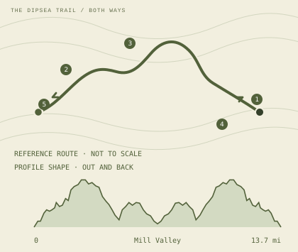
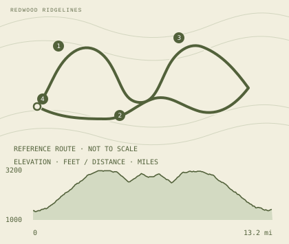
Marin County, California 01 / routes DOUBLE DIPSEA +4,500 ft
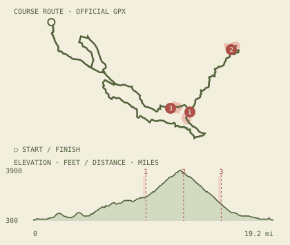
Double Dipsea Stinson to Mill Valley and back on the Dipsea Trail, via Cardiac Hill, Muir Woods, and Old Mill Park.
Typically held August*
TURNAROUND CARDIAC MUIR WOODS OLD MILL / TURN START / FINISH Published cutoff checkpoints: Old Mill Park (6.8 mi), Muir Woods Aid (8.6 mi), Cardiac Aid (10.6 mi).
Brazen course notes ↗
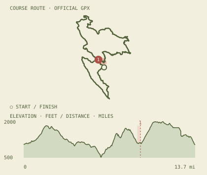
Lake Chabot, California 03 / routes HALF MARATHON +2,075 ft
Brazen New Year’s Day Half A mostly-dirt loop around Lake Chabot, run in reverse from the New Year’s Eve course.
Typically held January*
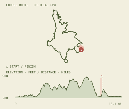
Cutoff checkpoints
Aid station · 10.7 mi Profile drawn from the organizer’s published route. Elevations and route versions may vary.
Brazen course notes ↗
HALF MARATHON +2,075 ft
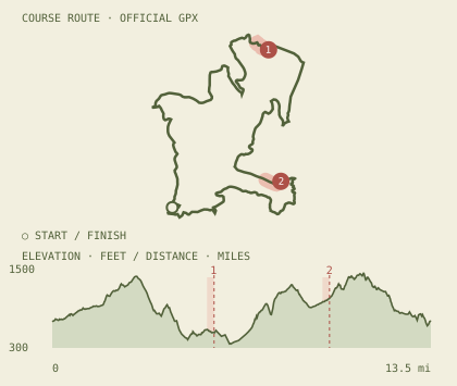
Bad Bass Half Marathon A Lake Chabot loop with rolling hills and a power-hike climb up Live Oak.
Typically held July*
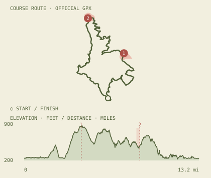
Cutoff checkpoints
Aid station · 4.3 mi Aid station · 8.7 mi Profile drawn from the organizer’s published route. Elevations and route versions may vary.
Brazen course notes ↗
HALF MARATHON +2,075 ft
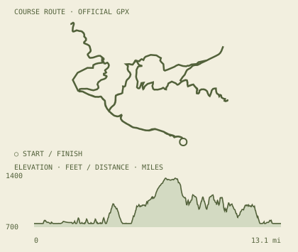
Brazen “Almost” New Year’s Eve Half A rolling Lake Chabot loop, with the half course mostly on dirt trail.
Typically held December*
Profile drawn from the organizer’s published route. Elevations and route versions may vary.
Brazen course notes ↗
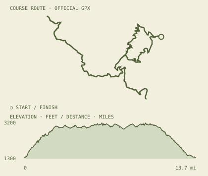
Mount Diablo, California 04 / routes HALF MARATHON +2,492 ft
Diablo Trails Challenge Dirt trails climb from Castle Rock toward Curry Point, then loop back through Mount Diablo State Park.
Typically held April*
Cutoff checkpoints
Curry Point · 7.9 mi Profile drawn from the organizer’s published route. Elevations and route versions may vary.
Brazen course notes ↗
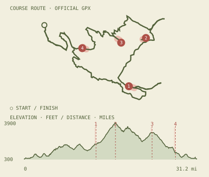
50K +8,246 ft
Diablo Trails Challenge Castle Rock, Rock City, Curry Point, the summit, Juniper, and Burma mark the long mountain loop.
Typically held April*
Cutoff checkpoints
Curry Point · 13 mi Summit · 16.5 mi Juniper · 23.1 mi Burma · 27.3 mi Profile drawn from the organizer’s published route. Elevations and route versions may vary.
Brazen course notes ↗
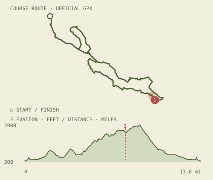
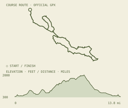
HALF MARATHON +2,492 ft
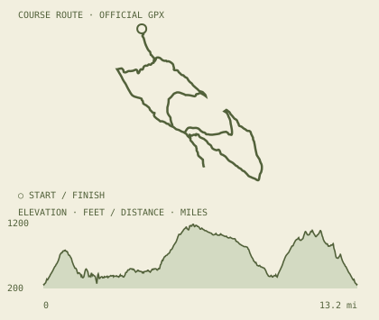
Diablo Summit Stomp Dirt trails climb from Castle Rock into Mount Diablo State Park; the longer 30K reaches the summit.
Typically held October*
Profile drawn from the organizer’s published route. Elevations and route versions may vary.
Brazen course notes ↗
30K +4,254 ft
Diablo Summit Stomp The longer climb runs from Castle Rock to the Mount Diablo summit, with a high-country return.
Typically held October*
Cutoff checkpoints
Helipad · outbound · 9 mi Summit · 12 mi Helipad · return · 15 mi Profile drawn from the organizer’s published route. Elevations and route versions may vary.
Brazen course notes ↗
East Bay parks, California 04 / routes HALF MARATHON +1,948 ft
Badger Cove Half Marathon A hilly loop through the emerald trails and rolling ridges around Lake Del Valle.
Typically held April*
Profile drawn from the organizer’s published route. Elevations and route versions may vary.
Brazen course notes ↗
HALF MARATHON +2,204 ft
Wildcat Half Marathon Fire-road climbs with a singletrack stretch and wide Bay views from Wildcat Canyon.
Typically held May*
Profile drawn from the organizer’s published route. Elevations and route versions may vary.
Brazen course notes ↗
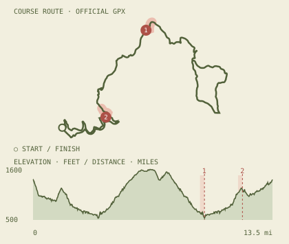
HALF MARATHON +3,088 ft
Bear Creek Half Marathon A rolling Briones loop finishes with a shaded 1.1-mile singletrack descent.
Typically held August*
Cutoff checkpoints
Aid station 2 · 5.79 mi Aid station 3 · 9.92 mi Profile drawn from the organizer’s published route. Elevations and route versions may vary.
Brazen course notes ↗
HALF MARATHON +3,989 ft
Rocky Ridge Half Marathon A figure-eight through Las Trampas climbs out of the valley, crosses east, and reaches Rocky Ridge Trail.
Typically held September*
Cutoff checkpoints
Aid station 3 · 9.36 mi Profile drawn from the organizer’s published route. Elevations and route versions may vary.
Brazen course notes ↗
Santa Cruz Mountains, California 02 / routes HALF MARATHON +2,906 ft
Trailquake Half Marathon Redwoods, fire roads, and singletrack lead to the high point of Sanborn Park.
Typically held May*
Profile drawn from the organizer’s published route. Elevations and route versions may vary.
Brazen course notes ↗
HALF MARATHON +2,867 ft
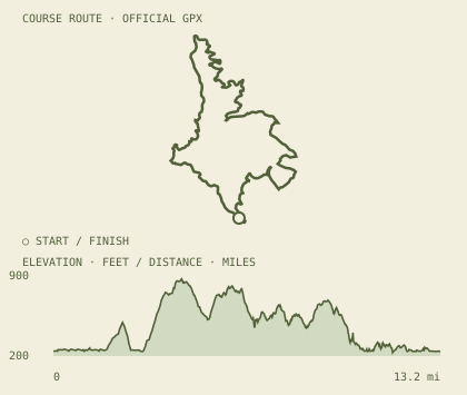
Summit Rock Half Marathon Fire roads and singletrack climb through Sanborn’s redwoods to high ground and open views.
Typically held December*
SANBORN SINGLETRACK SUMMIT ROCK START / FINISH Brazen course notes ↗
Auburn, California 01 / routes HALF MARATHON +2,465 ft
The Auburn Half Marathon Western States Trail to No Hands Bridge and toward Cool, then back to Overlook Park.
Typically held September*
Cutoff checkpoints
Aid station 4 · 9.7 mi Aid station 5 · 11.85 mi Profile drawn from the organizer’s published route. Elevations and route versions may vary.
Brazen course notes ↗
Salmon overlays indicate approaches to published cutoff checkpoints, not verified withdrawal hotspots. Maps and profiles are illustrative and not for navigation. Double Dipsea and Summit Rock use original brand-styled redraws. Check official course maps before heading out.